OSG GNSS CORS
OFFICE OF THE SURVEYOR-GENERAL
GNSS CORS
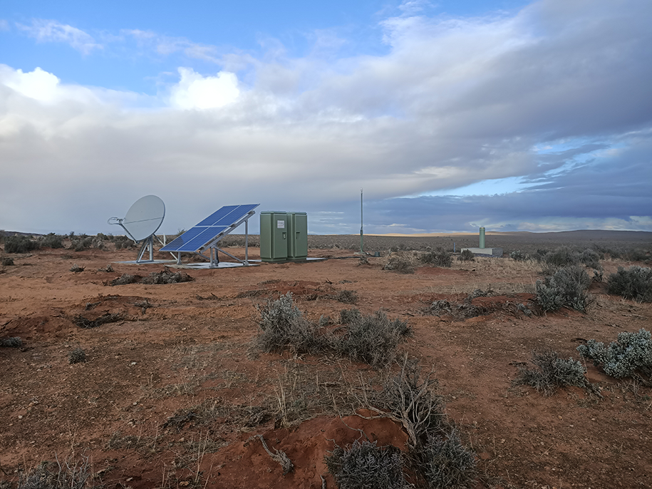
GNSS CORS site at Yunta, South Australia
The South Australian GNSS Continuous Operation Reference Station (CORS) Network is an essential geodetic infrastructure that ensures accurate positioning for users across South Australia. It serves as a reliable reference frame, supporting various precise positioning and guidance applications throughout the state. These applications include:
- Surveying: The network enables precise measurements and data collection for cadastral and geodetic surveying purposes.
- Mapping: Accurate positioning information from the network aids in the creation of detailed and up-to-date maps.
- Precision Agriculture: Farmers and agricultural professionals can utilise the network for precise positioning and guidance in agricultural activities, optimising resource usage and crop management.
- Construction: The network provides accurate positioning for construction projects, facilitating precise location and alignment of structures.
- Mining: The mining industry benefits from the network by ensuring precise positioning for mining operations, improving safety and efficiency.
- Navigation: Users can rely on the network for accurate positioning information during navigation activities, both on land and at sea.
- Natural Hazards and Emergency Response Services: The network supports emergency response services by providing accurate geodetic data and positioning for disaster management and response planning.
- Scientific Research: The network aids scientific research in earth sciences and weather forecasting by offering precise positioning data for geodetic, geophysical, geological and meteorological studies.
Coordinates and maps
Coordinates and accuracies of the South Australian GNSS CORS are determined in the GDA2020 geodetic reference frame and are subject to Geoscience Australia Regulation 13. Coordinates, information, and maps of the CORS can be found in the Geoscience Australia website.
Access to GNSS data and positioning services
Geoscience Australia provides open access to the historic data and data streams observed from all stations that contribute to the National Positioning Infrastructure Capability.
Receiver independent exchange data (RINEX) from South Australian CORS can be accessed through the Geoscience Australia GNSS Data Centre.
Differential GPS real time data (DGPS) and real time kinetic data (RTK) from single stations of South Australia can be accessed freely through the Geoscience Australia AUSCORS NTRIP Broadcaster.
RTK Network services are available for access via subscription through a network of Australian based Value-Added Resellers (third-party service providers such as AllDayRTK, HxGN SmartNetAus, VRSNow, and Mondo Pin). These Value-Added Resellers combine the Geoscience Australia data streams with their own infrastructure to provide supported positioning services, which are available across most areas of South Australia with access to mobile phone coverage.
We acknowledge and respect Aboriginal peoples as the state's first peoples and nations, and recognise them as traditional owners and occupants of land and waters in South Australia. Further, we acknowledge that the spiritual, social, cultural and economic practices of Aboriginal peoples come from their traditional lands and waters, that they maintain their cultural and heritage beliefs, languages and laws which are of ongoing importance, and that they have made and continue to make a unique and irreplaceable contribution to the state. We acknowledge that Aboriginal peoples have endured past injustice and dispossession of their traditional lands and waters.